Wednesday 21 December 2011

MERRY CHRISTMAS AND HAPPY NEW YEAR

We have been having an amazing time travelling, exploring, and trying to relax.  We have gone coast to coast across Canada which was truly amazing – you should all take a look at our own country.  So far we have been everywhere except Newfoundland and the Northwest territories which will be our next journey.  The people, the sights were fantastic!!!  We made a point of doing this before we headed anywhere into the USA.  


Down the west coast from BC/Washington and across to Arizona, was a great adventure.  We have seen ocean, desert, mountains and plains.  We have met people from all walks of life and times of life and have not met a bad one; RV people are the same as boaters, they enjoy the same lifestyle and it does not matter who or what you are.


We are not finished our journey, we are going into 2012 with some new travel plans and destinations. 


We have missed family and friends, but have tried to keep in touch as much as we could.   Friends we have made through our journeys have a large part in our hearts and future plans. We have missed some things that we would have gone to had we been home, but you have understood.


Today we spoke to my daughter Samantha, her husband Jeff and our grandchildren Brandon and Brittany to wish them a Merry Christmas, that is the hard part, but they understand, even Rosie does..  (I am now on the hook for Christmas and turkey dinner in the spring when we go back –she does not know it will be at her house….)


So to you all, a very Merry Christmas and Happy New Year and will continue the blog after Christmas

Love and kisses

Ken and Sandra

Sunday 11 December 2011

Lake Havasu to Yuma

December 4, 2011

bikers

more bikers

and still coming
Left Lake Havasu City, AZ today heading for Yuma, AZ.  Just north of Parker Dam we saw a police car and a few motorbikes behind, by the time we go to the dam, we must have passed over 200!  They were doing a drive for Toys we found out.  Some had Santa hats and different decorations on their bikes, and some looked like just regular Harley bikers.  I started to take pictures, but they just kept on coming around the corner, pretty amazing and the area they were riding would have been a great ride for them.


road to Yuma

different foliage again

Yuma proving grounds

Road to Yuma

 
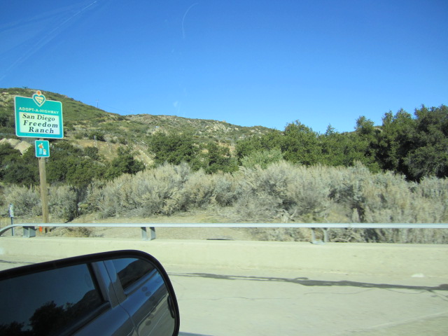
Road to Yuma down 95 was very straight.  This stretch of road, approx. 40 miles, also goes through the Yuma Proving grounds, which is where they conducts tests on medium and long range artillery, aircraft target acquisition equipment and armament, armored and wheeled vehicles as well as providing training for personnel for desert conditions.  There were signs everywhere that there was danger and no trespassing.  We were travelling on Sunday so did not see anything. The terrain had a bit different foliage again through this area. 

Before we left Lake Havasu, we had a call from Ken’s brother John who is driving truck and he was going to be in Yuma on so plan to meet up with him.

Arrived at RV Park, midafternoon set up and went to pick up John for dinner.  Had not seen each other before left Canada so it was a nice visit and nice to see a familiar face.

December 7, 2011


Cleveland Forest

Harbour by Motel


Motel ad

Yep, this is it

Harbour

 
Left today for San Diego for a couple of day trip, that was one of the reasons for stopping in Yuma.
Again, the terrain between here and San Diego changes so much, we travelled along Hwy 8, road for a while was very flat and straight.  Passed through Algodones Dunes which is west of the Chocolate Mountains along Hwy 8.  This is managed by the Bureau of Land management.  It is between the borders of Arizona, California and Mexico.  On the way to California, we went through a check point first of all to see if we had any fruit with us (same as when we went into state when we first came down).  Then along the way we went through 2 border control check points. These are mobile so they can set them up whenever and wherever they want to.  This stretch of highway is very close to border, you can see Mexico on the other side as well as the border fence some points along the highway.  Closer to California, we started heading back into mountains again so we climbed from Sea Level just outside El Centro and up to 4180’ at the peak of the mountain in California through to the Cleveland National Forest.  This is where we started seeing green again!  They had trees, and grass and water………
The mountain range through here has huge boulders and shows as falling rock; these are not from being blasted but are part of the Chocolate mountains, again amazing scenery and rocks.

We booked into a little flee bag hotel called the Dolphin that I found on line and it was exactly what it said it would be, whitewashed walls, floors, everything, doors had keys, yes real keys, neon lights outside and it was right off Mission bay by point Loma.  I had read that it could be noisy, but since we had the heater on at a decibel level of 115, did not hear anything else!!  (they were very friendly and helpful, had  continental breakfast, when we were leaving, one of the owners said we should have gotten a space heater for the room as they had them, guess they don’t leave in room in case they get stolen)even found a barber for Ken for the next day.

We went downtown to take a trolley tour through town, we have found these to be one of the best types to take, a hop on and hop off, shows you quite a bit of the city that you would not be seeing necessarily on your own and the drivers are talking all the time.  Since we arrived early afternoon, we just stayed on the tour for the whole time and there was just one other couple, from Atlanta with us most of the time.  Tomi, was the driver and she was good, had sound effects for different areas, music so went well.  Toured the Old Town district which was the birth place of San Diego, went to Balboa park where the Zoo is, no did not go, not crazy about seeing animals behind bars, but the park itself, is larger than Central Park in New York and houses several different museums. When we finished this, we went for a drive along the bay and it was rather cool out. Went down to one of the beaches. Picture taking is rather difficult as we were constantly moving and the window had an obstruction, but we did get to see a lot.  We decided to look for Cabrillo point that we wanted to see the next day and ended up at the Naval Base sentry station, nice young man with a large rifle turned us around and pointed to the way out.  We keep doing this, when in Atlanta, we went to the Airforce base by mistake.  All we need now is somewhere to bet lost near Army based and would have been in all of the forces downs here!!!!  After some touring the manager at motel recommended a seafood restaurant on the bay that was quite good.  Unfortunately, it was cold here as well so we sat inside but could see the bay from the window.


Aircraft carrier going out to see

Bridge to Coronado Island

Cabrillo monument

Mexico border

Mountains of rock

New lighthouse, squint and you can see on top of palm trees

Old light house

Pacific ocean tide pool

Rosencrans Cemetery

Sand dunes


USS MIDWAY

On deck air craft carrier

View San Diego from Point Loma


The next day, we went to Point Loma and Cabrillo monument.  If you look closely at a map of San Diego, this is the tip of the point and where the rest of the base is, which this is actually around.  The view was amazing, we went to the monument and then to the old lighthouse.  While we were there, an aircraft carrier was coming out from the bay going to sea, these are huge.  This area is also where they can sometimes see the whales come in, that is usually mid-December to January, but we have not seen any signs of them. This is also the largest military cemetery, bigger than Arlington, VA and Punchbowl of the Pacific in Hawaii combined.   
From there, we went to the USS MIDWAY museum, which is actually on the aircraft carrier. The ship is 1001’ long by 258’ wide and was the 20th century’s longest serving carrier, to see this go to www.midway.org. The pictures and specs they have on are amazing.  Another couple of hours spent touring this as well.  It was warm on top of the flight deck in the open, but once again, cooled down really quickly.


We are going to be leaving here on Monday the 12th and heading across to Arizona City, AZ to spend some time with friends of ours that have been full timing for a while and from there?????  We have lots of sun here but no warmth so now our focus is twofold, follow the sun AND the heat…..


Monday 28 November 2011

November 27 2011 Christmas at Lake Havasu City

Christmas is coming, even here! We went downtown for the Festival of Lights, went to a little pub to wait, temperature in mid-70’s. At 6:00 pm they had 20 swimmers, race to cross the channel (200 meters) and the winner got to turn on the lights. It felt very surreal to me as we would normally have very cold weather, Santa came and he was driving in a golf cart as it was easier to get around to his waiting chair. It also happened to be the same weekend that Streetsville turned their Christmas lights, and they had gloves and mitts on.


Swimmers


November 23, 2011Route 66

Arizona has one of the longest stretch of Route 66 also called the “Mother Road” remaining in the USA, so we decided to take a small journey and “get our kicks on route 66”. We left here for Topock which is mile 0 for Route 66 in Arizona. This is a two lane highway and along the route we saw several motorbikes that must have been having a ball on the road. Did not realize until we started travelling that we would be going through the Black Mountains at this point. The road had hairpin turns; the speed limit at some of the sections was 10 miles an hour! While going over some of the hills, you can’t even see where the road is on the other side. This whole section was built around the mountain rather than through which is what is normally done.

It was pretty barren then we came into Oatman which is an old mining town and considered a ghost town. One of its claims to fame is supposed to be the burros that wander around town – guess what, we did not see ONE. They had a few shops on the main street where people at least do stop, some souvenir shops. At 12:00 and 2:15 they have a “shoot out” on Main Street. We stayed to see this, with cowboys and real guns, but with blanks. They have the people stand in middle of the road to stop traffic and to better see the show. They are Shriners as well and after they are revived, the cowboys pass the hat, kind of a neat way to keep interest in the town and help out good cause as well. Travelling from here to our next stop, we did pass an open mine that was working, could see the openings in the mountains as well as the mine shafts. All of this is right along the highway. Again, the road was twisty and turny the whole time. We drove on the right hand side hugging the mountains on the way up, the other side of the road had no guard rails anywhere so at Sitgreaves Pass, you are looking down 3556’. I have one picture showing the road that I downloaded from the internet – can’t call it mine- that shows what the roads were like.
The official photographer had a senior’s moment and she forgot to check the camera to make sure there was enough power, so only got some of the pictures. Probably would not have been able to take more anyway as was mesmerized by the road and the drop. When road was originally built, apparently the old model T’s had to go up this same road backward – people hire locals to do it. Gravity fed engine did not get enough gas.

We eventually reached a plateau, just outside of Kingman and were flat from there. This is more of a city, but a lot of places closed up, they only had a museum in town, which we missed. It was not as interesting as Oatman but it is another mining town. We stopped for lunch at MR D’s in Kingman, old time diner, great hamburgers. Coming into the town though, is an Adult correctional institute, bail bondsman and lawyers, on the other side, is a youth detention center, so not sure if I would want to spend much time on here. So I guess between the mines and these places that would be most of the workforce.

It was a neat day trip, even though it was only actually 56 miles along the route, mostly through the mountains. This road was completed from Chicago to Santa Monica, CA in 1937. How they got there and did that road is another feat of engineering.


November 22, 2011 Lake Havasu - California and Arizona

Went back downtown and had a ferry ride across on the Indian reservation right on the lake, which is owned by Chemehuevi Indian Reservation, it is an RV resort and casino. There is a small store and several mobile homes there for the tourists as well. The ferry is called the Dream catcher and is $3.00 to get over to the other side and free return. We saw several school age kids taking it a few days before when we were on the down and the reason for this is that the schools are on this side so they go to school in Arizona. If the lake is too rough, they can get a bus to pick up people and return, but this is over an hour and a half trip. The lake crossing, barely takes 20 minutes. We had lunch, did a walk around and spoke to manager while we were there. He recommended several places to see, quite a few we already knew about but he was very pleasant. The RV part of the resort was not very impressive but for a stay of a night or two would be OK. Casino small, we made our small donation and came back home. Best part of trip, was the boat ride, for 3 bucks, can’t go wrong and if another hot day, may do again. Saw a couple of more of the light houses along the lake as well.


California side

Lake |Havasu skyline


London Bridge

Wednesday 16 November 2011

Parker dam and burros

Sunday November 13,2011

Did an afternoon trip today to Parker Dam which is the deepest dam in the world, with 73% of it height of 320’ below original waterbed. It’s primary purpose is to supply reservoir storage which is what Lake Havasu is, a 45 mile long with 450’ elevation.
After viewing the dam, we went came back through the other side – California to Parker AZ through the back country – difference in scenery again from what we have previous seen. The different aray of mountain terrain is spectacular, just like the pictures they do of the state. Again we were warned about burros. Well, this time we did spot some on the side of the road and I now have evidence that they are out there, there were right by the side of the road, not bothering any one, just munching on shrubs.